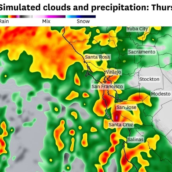
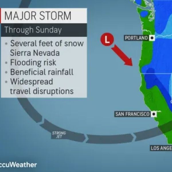
California could face an unusual tornado risk this week as thunderstorms sweep through the Bay Area and Central Valley from Tuesday night through Friday. Officials are already warning of damaging winds, heavy rain, and blizzard-like snow, but meteorologists say conditions could also produce waterspouts and tornadoes along the coast.
A rare alignment of atmospheric factors is creating the potential for twisters. While the overall risk for any specific location remains low, scientists say it’s likely that at least one tornado could form somewhere in the state. The Central Valley is also at risk of funnel clouds and brief tornadoes on Wednesday.
“This is the most favorable setup for more than a couple waterspouts or brief tornadoes that I’ve seen in quite some time in this part of the world,” said Daniel Swain, a climate scientist at UC Agriculture and Natural Resources.
The National Weather Service’s Storm Prediction Center forecasts a slight chance of tornadoes along the California coast and in the Central Valley on Wednesday. Thunderstorms may bring quarter-size hail, lightning, and damaging gusts.
The first wave of tornado risk begins Tuesday night as a cold front approaches the coast, with the potential for waterspouts or brief tornadoes anywhere from Crescent City in Del Norte County to Santa Barbara. The threat expands toward Los Angeles on Wednesday as storms push eastward, bringing erratic winds and heavy rainfall.
Wednesday afternoon could bring severe thunderstorms in the Central Valley, with tornado chances highest from Chico to Fresno, especially if sunshine breaks through the clouds. This would heat the ground and increase atmospheric instability, a key factor in tornado formation.
Tornado chances are highest in the Bay Area on Tuesday and Wednesday nights. Residents are urged to have multiple ways to receive emergency alerts if a tornado warning is issued overnight. Coastal areas from Point Arena to Point Conception could face another tornado risk late Christmas Eve through Christmas Day as a second storm moves in, increasing the likelihood of waterspouts or weak land-based tornadoes.
California typically lacks the conditions necessary for tornadoes, but this week’s storm combines moist subtropical air from nearly 1,000 miles southwest of San Francisco with colder Arctic air. Strong low-level winds could help storm cells spin into funnel clouds or tornadoes.
The National Weather Service placed San Francisco in a rare marginal risk for severe thunderstorms three days in advance, the first such warning for the city in at least a decade.
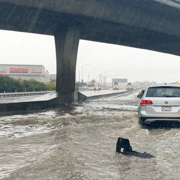
While a tornado is possible, most Californians face a greater threat from flooding and fallen trees caused by heavy rain and strong winds. December is the heart of California’s tornado season, with the state averaging nine tornadoes per year, mostly along the coast in winter and in the Central Valley in spring.
In December 2024, a tornado in Scotts Valley (Santa Cruz County) flipped vehicles and injured people, while a tornado warning in San Francisco that same day was attributed to straight-line winds that uprooted dozens of trees.
This article has been carefully fact-checked by our editorial team to ensure accuracy and eliminate any misleading information. We are committed to maintaining the highest standards of integrity in our content.




Leave a Reply