
A swarm just east of San Francisco is one of two in the area drawing attention from locals who believe the “Big One” may be approaching.
A swarm just east of San Francisco is one of two in the area getting attention from residents who think the “Big One” could be coming soon. Each dot represents the epicenter of an earthquake recorded over the past 30 days, with many clustered closely together and overlapping one another.
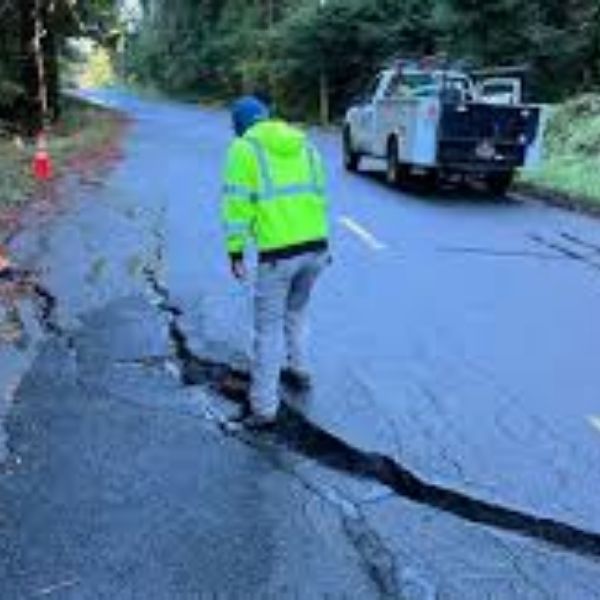
New earthquake swarms over recent days have left some Californians around the San Francisco area uneasy, worried that the “Big One” may be on the way. Recent major earthquakes in Japan and Alaska are adding to concerns that a significant quake could soon strike California. The USGS says the likelihood of a larger earthquake is high, though those odds apply over a long period of time and not necessarily in the coming days or weeks.
The “Big One” in California refers to a major earthquake, likely measuring 7.8 or higher, expected along the San Andreas Fault. Such an event could cause widespread destruction, heavy loss of life, and massive economic damage across the state. Scientists say there is a high probability of a major earthquake occurring in the coming years, estimating a 72% chance that a magnitude 6.7 or greater quake will hit the broader Bay Area between now and 2043. Unfortunately, USGS scientists note that even with modern technology and forecasting methods, they cannot narrow down when such a large-scale disaster will occur.
Because scientists emphasize that it is a matter of “when, not if,” ongoing moderate earthquake swarms near the Bay Area, combined with headline-making major earthquakes elsewhere in the world, have kept the region on edge.
While California ranks second in the US for seismic activity, most earthquakes are small and go largely unnoticed. That pattern has shifted in recent weeks due to two swarms affecting the Bay Area. One is located east of San Francisco near San Ramon, while the other is north of the city near The Geysers.
Over the past 30 days, the USGS has recorded 1,470 earthquakes around The Geysers. In just the last seven days, 286 quakes have occurred. Most have been weak, with only five earthquakes reaching a magnitude of 2.0 or higher during the past week. While the volume has raised eyebrows, the intensity has remained low.
Near San Ramon, the situation has been different. Over the past 30 days, the USGS has reported 139 earthquakes in the area, with 25 occurring in the last seven days. However, these quakes have been stronger overall, with 39 rated at magnitude 2.0 or higher and six reaching 3.0 or greater during the past month.
People are closely watching the two swarms. The orange area shows a higher number of earthquakes with lower intensity, while the red area reflects fewer earthquakes that are stronger in magnitude.
According to the USGS, earthquakes with a magnitude of 2.0 or less are rarely felt or heard. Once they exceed 2.0, more people begin to notice them. While magnitude 3.0 events or greater can cause some damage, significant destruction and casualties typically do not occur until an earthquake reaches about magnitude 5.5 or higher.
The USGS explains that a swarm is a sequence of mostly small earthquakes without a clear mainshock. “Swarms are usually short-lived, but they can continue for days, weeks, or sometimes even months,” the agency notes.
Experts say these seismic swarms are not unusual. Similar activity occurred in 2002, 2003, and 2015 along the Calaveras Fault, which is part of the larger San Andreas and Hayward fault system. While these smaller earthquakes may release some stress, they do not eliminate the risk of a major event.
Volcanic arcs and oceanic trenches partially encircle the Pacific Basin, forming what is known as the Ring of Fire, an area with frequent earthquakes and volcanic eruptions. Trenches appear in blue-green, while volcanic island arcs run parallel and landward of them. For example, the island arc linked to the Aleutian Trench is represented by the long chain of volcanoes that make up the Aleutian Islands. Image; USGS.
Volcanic arcs and oceanic trenches partially surrounding the Pacific Basin form the Ring of Fire, a region known for frequent seismic activity and volcanic eruptions. The trenches are shown in blue-green, while volcanic island arcs lie parallel to and landward of them. One example is the island arc associated with the Aleutian Trench, represented by the long chain of volcanoes that make up the Aleutian Islands. Image; USGS.
With other regions experiencing major earthquakes, some fear these swarms could signal a larger event in California. A magnitude 7.0 earthquake struck Alaska on December 6, followed by a 7.6 magnitude mega-quake in northern Japan on December 8 that triggered tsunami advisories across a wide area. While these events are not directly connected, California, Alaska, and Japan share one key feature: they are all located along the Ring of Fire.
The Ring of Fire is a continuous zone of seismic and volcanic activity that borders the Pacific Ocean. About 90% of the world’s earthquakes occur along this belt, which also contains roughly 75% of Earth’s active volcanoes. The Ring of Fire exists because of plate tectonics, as Earth’s plates constantly move atop a layer of solid and molten rock known as the mantle. Where plates collide, pull apart, or slide past one another, as they do around the Ring of Fire, earthquakes and volcanic activity are common.
This article has been carefully fact-checked by our editorial team to ensure accuracy and eliminate any misleading information. We are committed to maintaining the highest standards of integrity in our content.


Leave a Reply