
After a record-breaking New Year’s Day downpour in Southern California, more rainfall is expected across the region.
The National Oceanic and Atmospheric Administration’s Weather Prediction Center forecasts a strong system approaching California and the Pacific Northwest, bringing additional heavy rain and mountain snow. AccuWeather senior meteorologist Alex Sosnowski said the “rain through Friday will occur with the main storm hovering well offshore over the Pacific.”
Heavier rainfall is expected early next week in Northern and Central California. “An atmospheric river may form, further enhancing the rain with the potential for widespread flash flooding and mudslides,” Sosnowski reported.
From Friday through Saturday, much of the rain is expected to remain north of San Diego and Los Angeles, and northwest of Las Vegas. Sosnowski said two to four inches of rain could fall during that period. The National Weather Service has issued coastal flood advisories for parts of the south-central Oregon coast and northern California, including the Bay Area.
“Rainy weather is expected to continue for much of Coastal California through Tuesday as multiple storm systems will move through the state,” AccuWeather meteorologist Kai Kerkow told The Mirror US.
“Rain can be heavy at times, bringing the risk for flooding, especially in urban and poor drainage areas. From Friday evening through Monday evening, AccuWeather is predicting 2-4 inches of rain across much of the California coast. From Wednesday through late next week, the storm track will begin to shift north, bringing a drier pattern and a break in the wet weather from the Bay Area south,” he added.
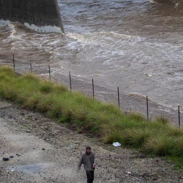
These conditions are expected to worsen already saturated ground following recent rainfall. The New Year’s Day storm marked the first time rain fell on the Rose Bowl Parade in years. The Los Angeles County Fire Department said it rescued more than 100 people and one dog from flooding on Christmas Eve.
Rain has fallen on only 10% of New Year’s Days between 1878 and 2025, according to the National Weather Service. The holiday rainfall record was set in 1934, when Pasadena received 3.12 inches.
Heavy snow is also forecast for the Sierra Nevada and possibly the Siskiyou Mountains in Northern California, which could cause major travel disruptions. “By early next week, snow levels may dip to 4,500 feet in the northern Sierra Nevada,” said AccuWeather Storm Warning Meteorologist William Clark.
“This would correlate to a long stretch of wintry conditions along Interstate 80 in the higher elevations, with several feet of snow possible over Donner Pass, California,” he added. The ongoing rain comes as a flash flood warning remains in effect due to thunderstorms moving through the area.
The National Weather Service issued the warning at 6:33 a.m., and it is set to remain in effect until 9:30 a.m. Forecasters said about 1.5 inches of rain have already fallen, with rainfall rates expected to reach between 0.25 and 0.75 inches per hour.


Leave a Reply