
Up to 17 inches of snow will hit several U.S. states from Tuesday through Thursday, prompting the National Weather Service (NWS) to issue multiple winter storm warnings and urge travelers to “drive with extreme caution” or even delay all travel.
Why It Matters
Winter storms often bring heavy snow, ice, and strong winds that reduce visibility and make roads slick—sometimes impassable—creating dangerous travel conditions, especially during busy morning and evening commutes.
What To Know
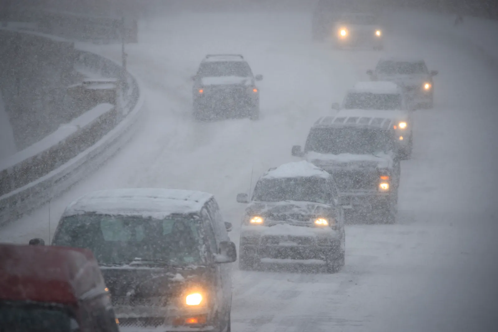
Vehicles drive in heavy snow on the Brooklyn-Queens Expressway, January 4, 2018 in the Brooklyn borough of New York City. | Drew Angerer/Getty Images
NWS winter storm warnings currently cover many areas across the U.S. The hardest-hit states include Maine, New Hampshire, Colorado, Montana, Wyoming, South Dakota, Alaska, and New Mexico.
Maine and New Hampshire
Parts of south central, southwest, and western Maine—and central, northern, and southern New Hampshire—could receive 6 to 9 inches of snow by early Wednesday morning.
Colorado
The Sangre de Cristo Mountains in Colorado could get up to 17 inches of snow from Wednesday morning through Thursday morning, making travel “very difficult to impossible.”
Larimer County, including Fort Collins, could receive 2 to 4 inches until Wednesday afternoon. Boulder, the Denver metro area, Castle Rock, and the Palmer Divide could get up to 6 inches, with 8 inches expected at the base of the foothills until Wednesday evening.
The southern Front Range Foothills could receive 5 to 11 inches by Wednesday night, the northern Front Range Foothills up to 8 inches, and South Park up to 6 inches.
In southern Colorado, the Wet Mountains, Wet Mountain Valley, Walsenburg Vicinity, the Upper Huerfano River Basin (below 7,500 feet), Trinidad Vicinity, and western Las Animas County (below 7,500 feet) could see up to 10 inches from Wednesday into Thursday.
The La Garita Mountains (above 10,000 feet), the eastern San Juan Mountains (above 10,000 feet), the Upper Rio Grande Valley, and the eastern San Juan Mountains (below 10,000 feet) could get 3 to 9 inches by Thursday morning.
Parts of Fremont County should expect 3 to 9 inches by Wednesday night, and the San Luis Valley could get up to 5 inches through Thursday morning.
Montana, Wyoming, and South Dakota
Montana and Wyoming, especially the northern and northeastern Bighorn Mountains, could see up to 3 inches of snow until Wednesday morning, along with 35 mph winds that may cause blowing snow and reduced visibility.
Most mountain passes in Montana could get 2 to 4 inches, while Kings Hill Pass might receive 5 to 8 inches. The NWS warned that travel could be difficult, especially along Highway 14 through Burgess Junction.
The Wyoming Black Hills and South Dakota’s northern Black Hills could see up to 5 inches by Wednesday morning.
Alaska
Eastern Norton Sound and the Nulato Hills, south of Shaktoolik, may get up to 2 inches of snow, and the Middle Yukon Valley could get up to 4 inches, with wind gusts reaching 40 mph through Wednesday afternoon.
The eastern Alaska Range—south of Trims Camp—and the southern Denali Borough could see up to 5 inches and winds of 45 mph until Wednesday. Summits along the Dalton Highway, the Yukon Uplands, White Mountains, areas south of the Yukon River, and the Yukon Flats could get up to 4 inches.
New Mexico
New Mexico’s mountain ranges and passes—including the Sangre de Cristo Mountains, Tusas Mountains (including Chama), the Glorieta Mesa (including Glorieta Pass), the Upper Rio Grande Valley, Johnson and Bartlett Mesas (including Raton Pass), and the northeast Highlands—could see up to 8 inches above 7,500 feet, with up to 10 inches on the highest peaks by Thursday morning.
What People Are Saying
The NWS for Maine advised travelers:
“Persons should delay all travel if possible. If travel is absolutely necessary, drive with extreme caution and be prepared for sudden changes in visibility. Leave plenty of room between you and the motorist ahead of you, and allow extra time to reach your destination. Avoid sudden braking or acceleration, and be especially cautious on hills or when making turns. Make sure your car is winterized and in good working order.”
It added:
“A snowstorm will bring plowable snow to the region with a period of moderate travel impacts expected. Periods of moderate and heavy snow will combine with low visibility to create dangerous driving conditions. Hazardous road conditions could linger into the Wednesday morning commute even after snow has ended.”
What Happens Next
Residents and travelers in affected regions should closely follow local weather updates for the latest information on storm conditions.


Leave a Reply